
Good morning North Texas. We have a chance for some winter weather late Tuesday into early Wednesday across the area, as a strong arctic system pushes through the region. 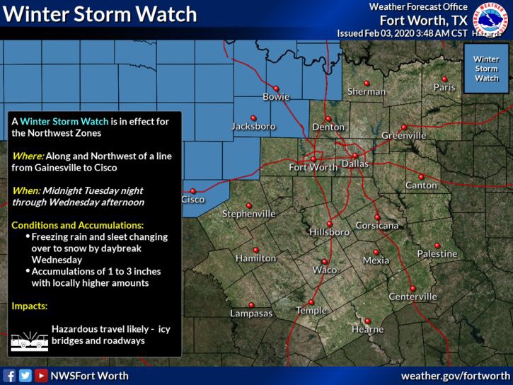
A Winter Storm Watch is in effect from Midnight Tuesday into Wednesday afternoon, for areas just north and west of the immediate 4 central DFW counties. Within the watch area, we’re monitoring for the risk for accumulations possible between 1-3″ if rain/freezing rain transitioning to snow. Hazardous travel conditions will be possible for areas within the Winter Storm Watch. 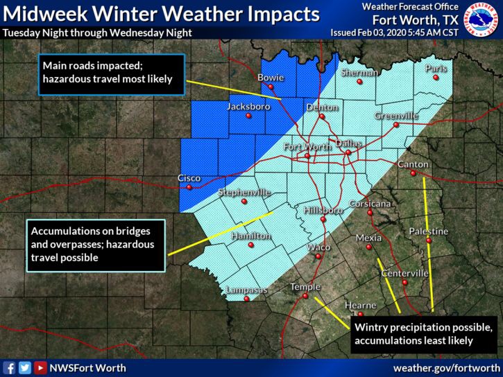
For the Immediate DFW Metroplex, there could be some minor travel hazards on area roads, as cold temperatures and any accumulation could cause some slick spots, especially on highway over passes and bridges. Does this mean no travel at all for DFW on Wednesday? No! This is a heads up in the event slick spots start to pop up across area roads. 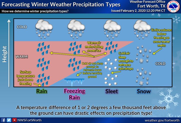
Here’s a quick graph of the different types of winter accumulation types, and how they form. More visit the NWS Website here
Stay tuned for further updates and forecast information.
Leave a Reply