
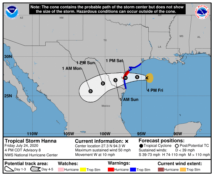
The National Hurricane Center has issued an updated forecast path for Tropical Storm Hanna, and now has it projected to impact the far Southern Texas coast as a CAT 1 Hurricane, by Saturday Afternoon.
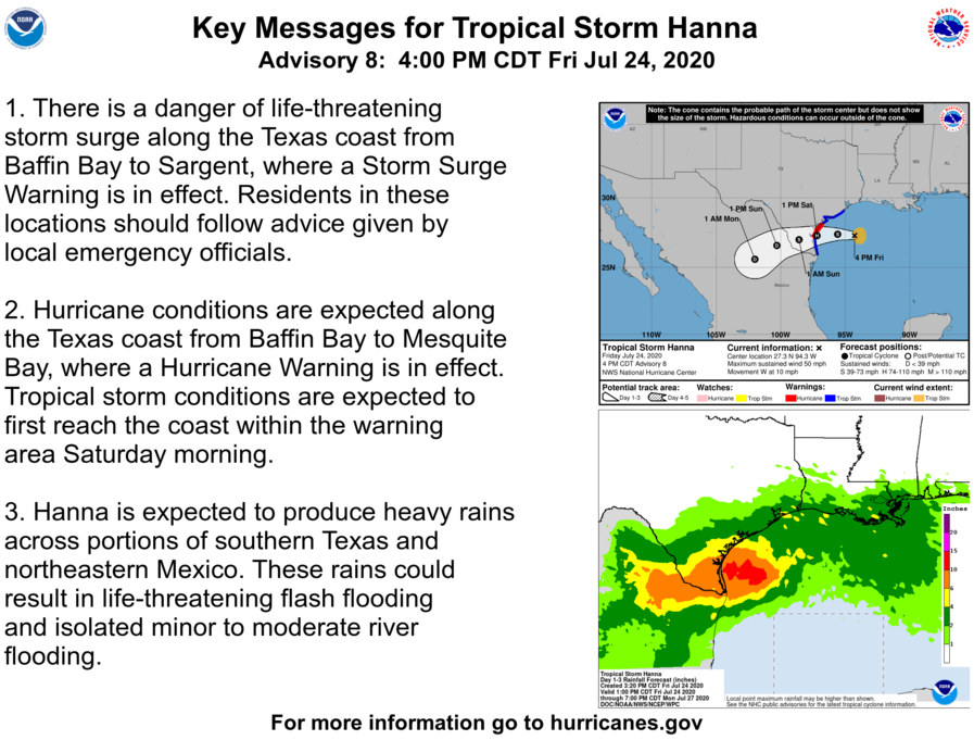
Dangerous to life threatening storm surge, as well as hurricane conditions: wind, and flash flooding, are expected in areas that will be impacted by this storm. Residents should heed advice from local officials and emergency management.
Track Hanna with our new Interactive Tropical Tracker map! (Find it on our menu above)
Tropical Storm Hanna is centered near 27.3N 94.3W at 24/2100 UTC
or 170 nm E of Corpus Christi Texas moving W at 9 kt. Estimated
minimum central pressure is 999 mb. Maximum sustained wind speed
is 45 kt with gusts to 55 kt. Numerous moderate to scattered
strong convection is observed north of 24N and west of 89W. Seas
in the area of the storm have increased to 13 to 17 ft, mainly in
the east semicircle. Hanna is expected to continue moving west
through the day Sat, and make landfall along the south-central
coast of Texas Sat afternoon or early evening. Strengthening is
forecast, and Hanna may become a hurricane before landfall. Please
read the latest NHC Public Advisory at
https://www.nhc.noaa.gov/text/ MIATCPAT3.shtml and Forecast/
Advisory at https://www.nhc.noaa.gov/text/MIATCMAT3.shtml for more
details.
Leave a Reply