
Good morning NTX. As previously mentioned in our forecast updates, a strong cold front will move into the region this evening into early Tuesday. 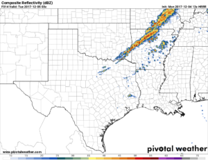
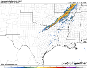
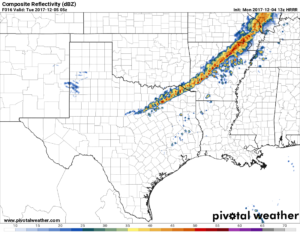
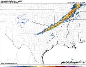 As seen in the images above, this is the latest run of the HRRR model as of 8:40am. The model shows showers and storms start to develop well north and NE of the area this evening in Oklahoma and Arkansas, before a few showers develop over the metro that will eventually become a thin line of showers and isolated thunderstorms storms along the cold front over NTX. The cold front will approach the region towards 8-10pm this evening and we could see rain activity starting near 9pm. Severe weather is not anticipated. Rain amounts wont be all to impressive with todays rain chances, totals less than a half an inch are expected. Its not much but we’ll take what we can get
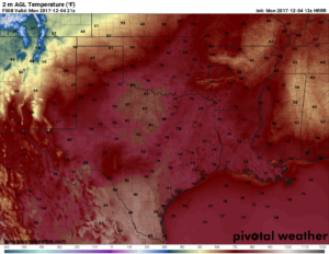 Highs projected for today will be in the upper 70s and into the 80s in some spots! Then as the front pushes through area temps will go from the mid 70s into the 50s and upper 40s.
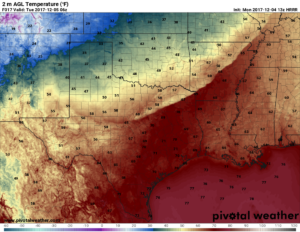 Tomorrow lower rain chances for light showers will linger throughout the day, as moisture streams over our atmosphere. Highs will be in the mid 50s with lows in the 30s!
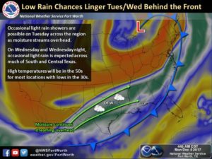
 You can track the rain activity later this evening on our sites Interactive radar!
Leave a Reply