
Good morning North Texas, we already started the morning bright and early with storms across the metroplex very early this morning, with hail across parts of Dallas, Tarrant, Johnson, and Ellis counties. For the rest of the day we will be monitoring a threat for storms this evening and tonight. We’ll get into the details in this blog post.
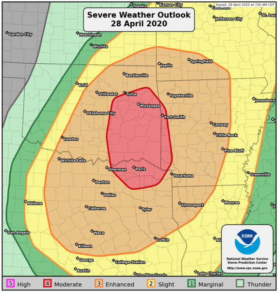
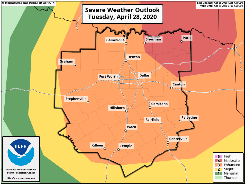
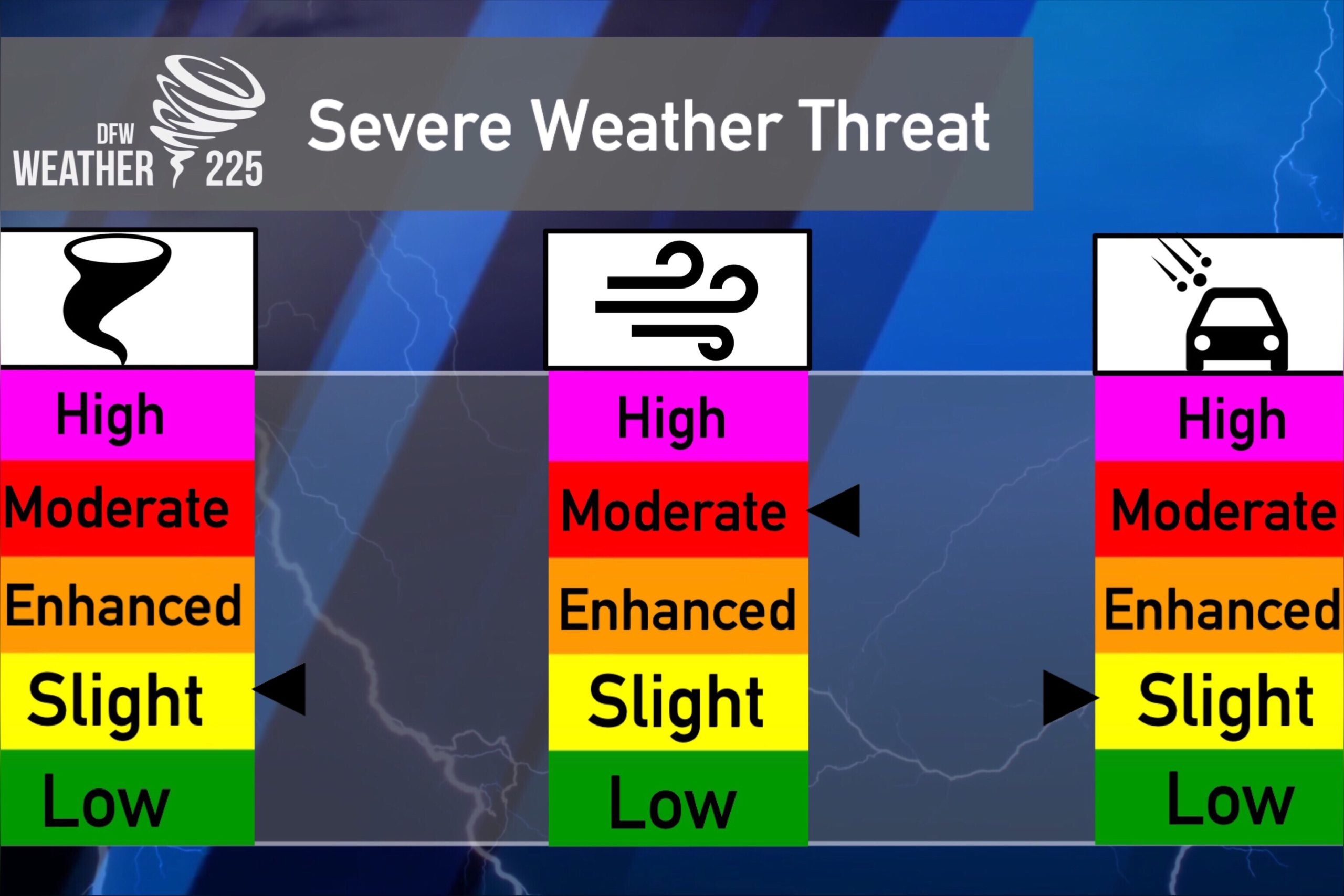
To start, the SPC has placed all of our coverage area in North Texas under a (3/5 orange) Enhanced Risk, with some of our red river and Northeastern counties under a (4/5 Red) Moderate Risk for storms. The SPC has issued a public outlook for this threat you can read here.
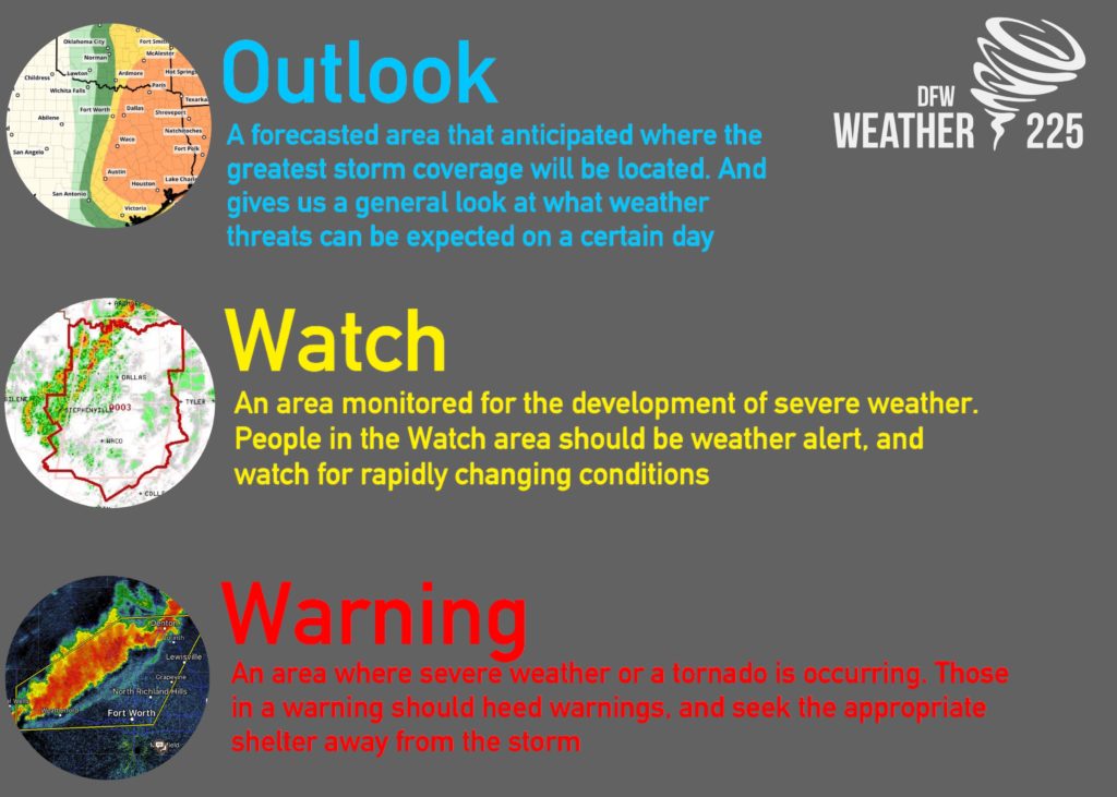
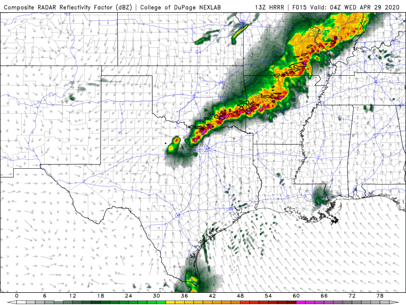
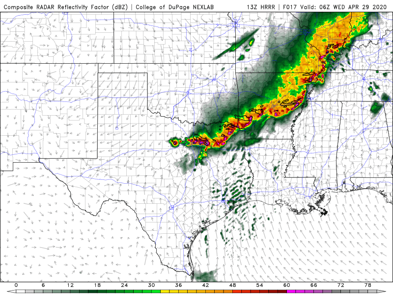
Outlooks, as we’ve previously mentioned, are issued categorically where the best coverage is anticipated. Today’s outlooks are higher than our typical (1/5) and (2/5) standard risks issued, because all of North Texas could see storms tonight, as a squall line will develop in parts of Oklahoma and push south into North Texas.
Our concerns for storms later will be for damaging, to possibly some destructive straight-lined winds associated with the squall line. As well as a few spin ups embedded in the line, as well as large hail possible.
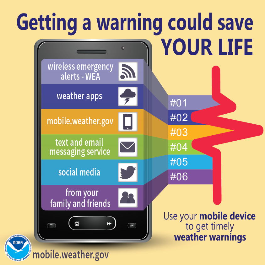
Timing for storms looks to be from 7pm-1am for our coverage area in North Texas. You will want to be weather alert this evening and tonight. Make sure you have a few ways to receive warnings.
If you live in a mobile home, especially along our red river counties, and counties North East in the Moderate Risk, it might be good to have a plan of where to go, as winds of this strength can be equally as dangerous as a spin up. If you live in a mobile home here in the metro area as well, it wouldn’t be a bad idea to have a plan in place as well, for where to go, as we also have a chance to see some intense winds.


Unlike the past few events we’ve either dodged or seen, the activity tonight will be widespread, and most of us may see some type of damaging wind threat as this squall line pushes through our region. There’s also some models showing some pop up storm development ahead of the main line that would eventually blend in with the main line of storms. If that verifies we would need to be alert for these as they could be capable of all types of severe weather, with large hail being possible with these. This part isn’t 100% certain, however, it’s almost certain that a line of storms will push through the region. Make sure you have a severe weather safety plan ready just to be safe, and as previously mentioned, have numerous ways to receive warnings.
Quick recap:
Timing: 7pm-1am for all the counties we cover
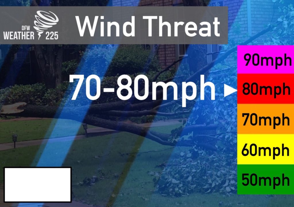
Threats: All types of severe weather, with damaging winds of 60-80mph, as well as brief spin ups within the line being the primary concern. Large hail will also be possible.
Preparedness: Make sure you have a way to receive warnings, as well as review your severe weather safety plan.
Stay tuned to Weather225 as well as other local trusted weather forecasters, and NWS for the latest.
Leave a Reply