
Good morning North Texas, this is a quick post about tomorrow’s storm chances across the viewing area. This is our current thinking, as of 10am (4/27/20). Stay tuned for updates.
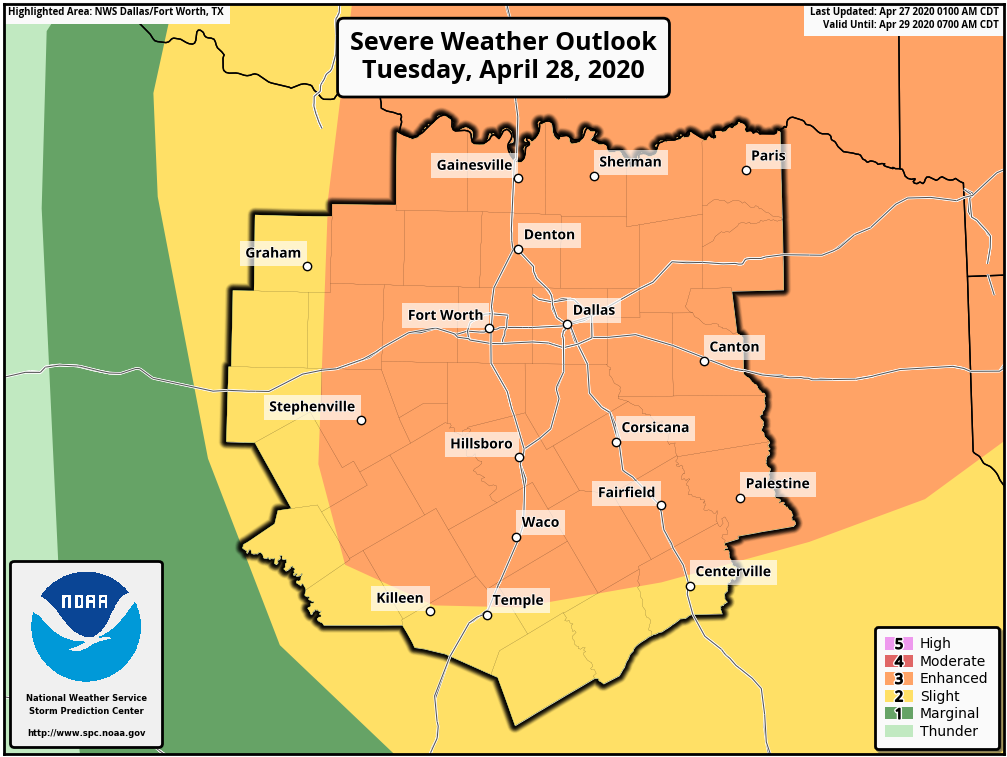
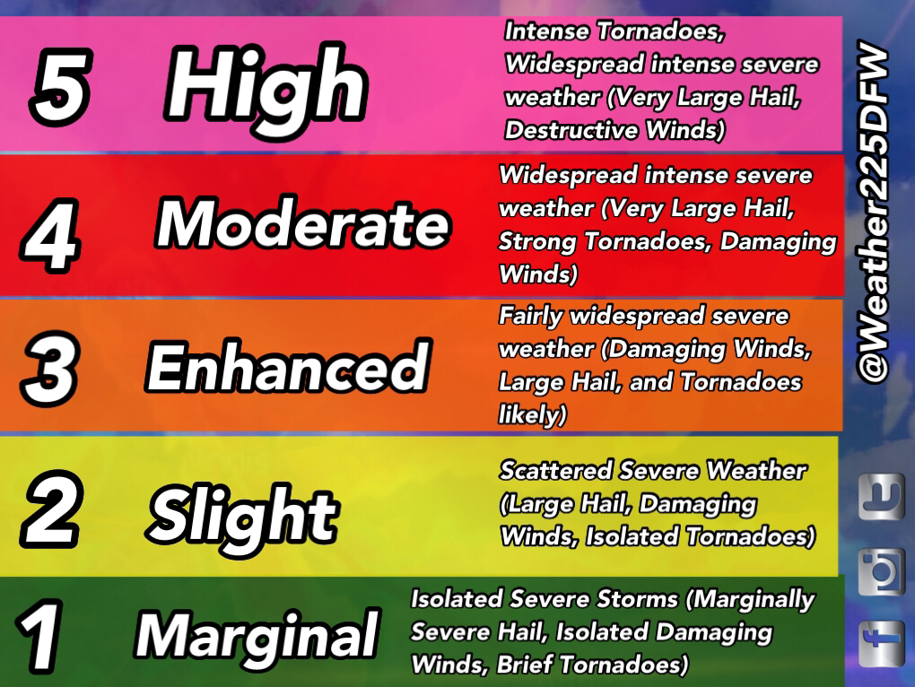
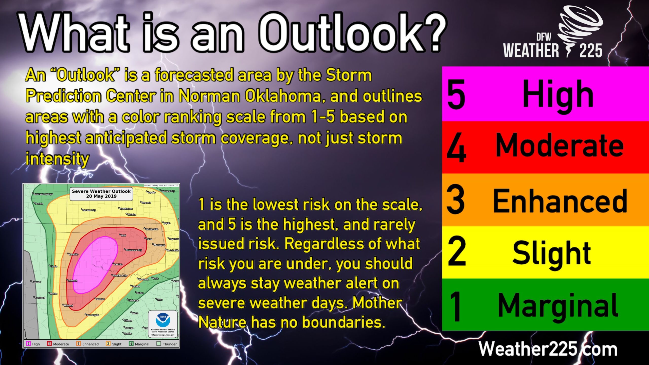
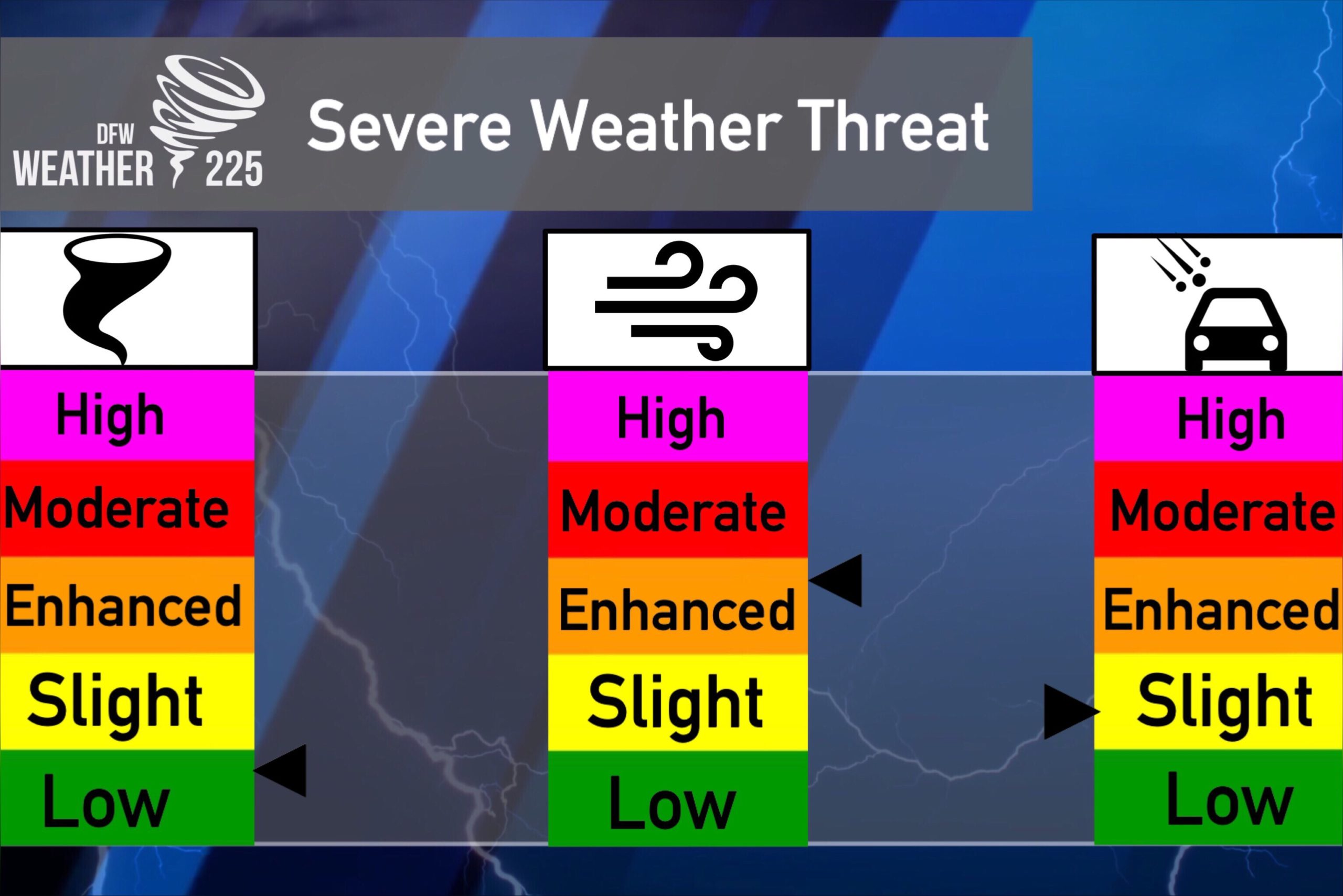
To start the forecast, the SPC has upgraded much of North Texas to an enhanced (3/5 orange) Risk for severe storms. Remember, these outlook categories are not just for storm intensity, they are placed where confidence is best for storm coverage.
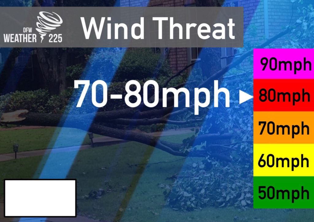
Unlike the past few events we’ve seen or dodged, it looks like a large majority of us will see storm activity late tomorrow evening into tomorrow night, as a squall line will develop in Oklahoma, and push Southeast into the area. The primary risks would be strong, to possibly some intense winds with this squall line of storms. 65-80mph Winds will be possible, as well as a few isolated embedded spin ups, and some hail near quarter sized possible.
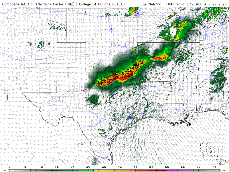
Conditions will be favorable tomorrow afternoon for severe storm development during the day and afternoon. However, at this point it appears a CAP over the area will most likely prevent any isolated activity development during the afternoon. We’ll keep an eye on that in case anything changes. Our main concern will be for the squall line that should push through the region late tomorrow evening. This later activity, and the cold front will have no trouble breaking through the CAP in the evening.
At this time, our latest thinking on timing for this squal line, will be between 8pm-2am for all of our viewing area.


There’s still some parts of this forecast that will be adjusted. So stay tuned for updates!
Leave a Reply