
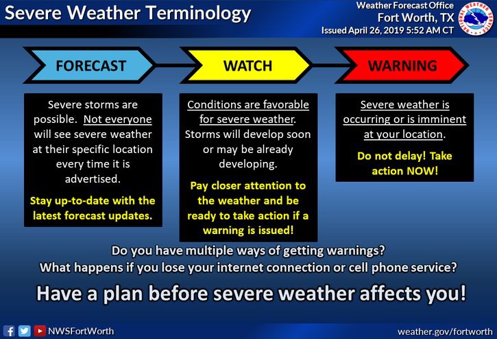
Good morning North Texas, we have a few things to mention this morning for today’s forecast. To start NOT everyone will see strong to severe storm activity today, however, we all have an equal opportunity to see storms, so it’s a good idea to go ahead and stay weather aware and make sure you have a way of receiving warnings!
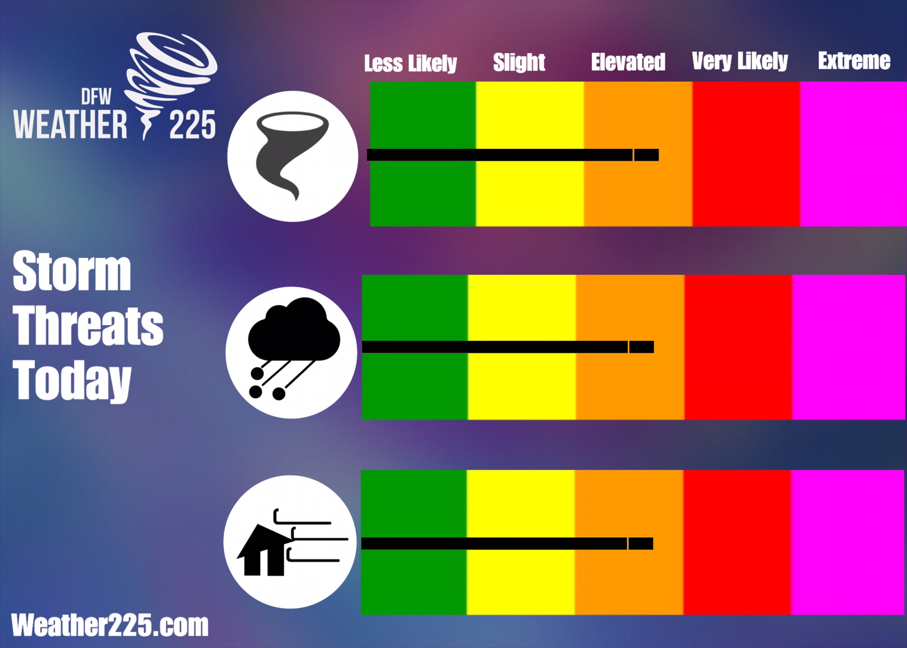
This morning the Storm Prediction Center (SPC) has placed a large area of North Texas under a (3/5) Enhanced risk for storm activity today into this evening, this includes all of the DFW Metro area. 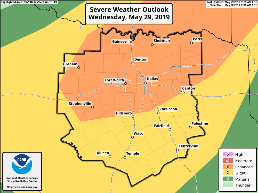
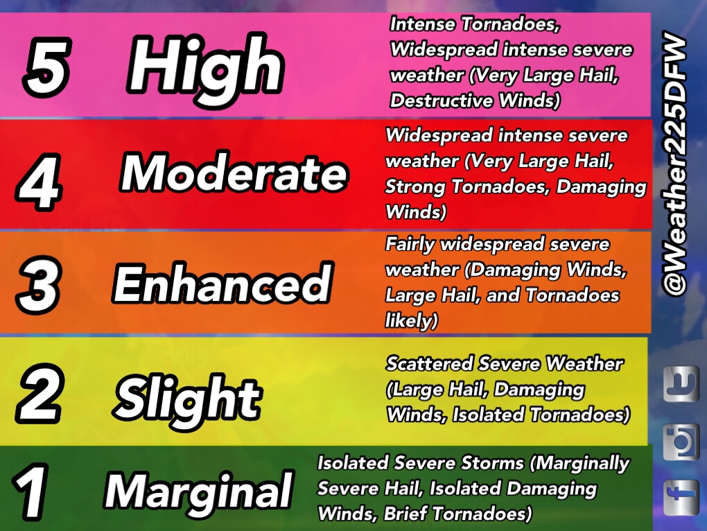
At this point the atmosphere today will be supportive for all types of severe weather, and as storms in west TX this morning move NE into Oklahoma throughout the day, model trends are suggesting the southern edge of these storms may be more cellular in nature, thus the SPC has labeled an Enhanced risk for Tornadoes, Damaging Winds, and Large Hail.
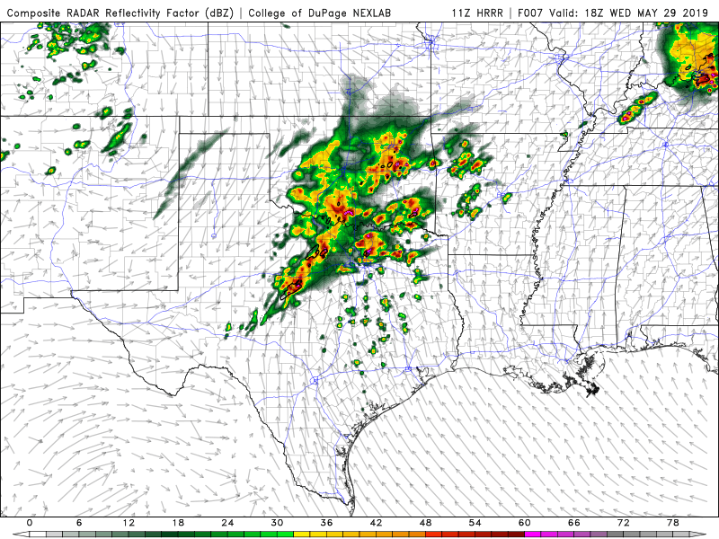
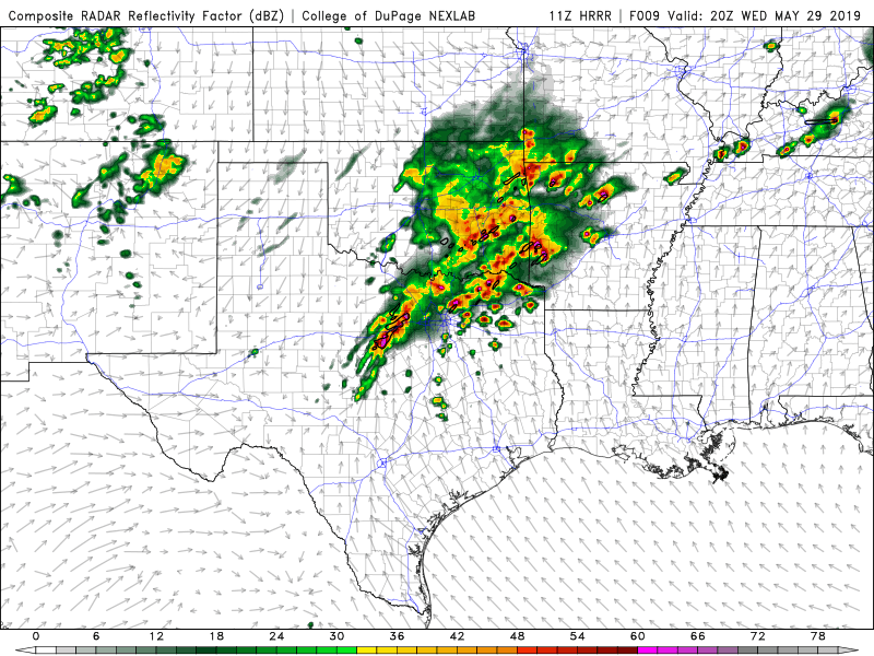
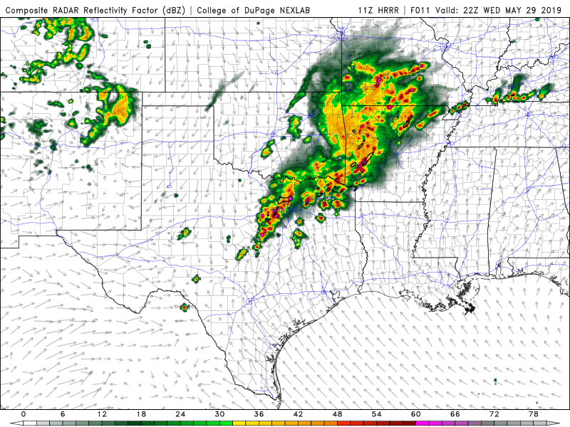
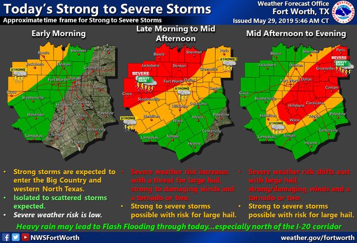
Bellow is a graph from the National Weather Service in Fort Worth on timing and hazards for storms today. Timing overall for our viewing area appears to be from 12pm-10pm. Once again all types of severe weather will be possible, so make sure you have a way to receive warnings today!
Should you cancel plans today cause of the risk for storms? NO! Not everyone today will see strong to severe storm activity today, however, we all have an equal opportunity to see storms, so stay alert of the weather!
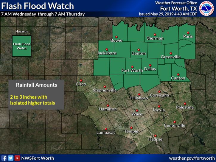
Another risk with storms today and tonight is the risk for flash flooding. We have a flash flood watch in effect until 7am Thursday. Between 1-3″ of rain is possible with storms, with isolated amounts of more possible.
Stay tuned for the latest!
Leave a Reply