
Good afternoon North Texas. We’ll talk in this blog post forecast, about the upcoming storm chances Tuesday night, and Wednesday across parts of the area. In this forecast we will also relay the information of what forecasters and us are thinking, as well as the uncertainties with this set-up, so you can have the information, with a non hyped up forecast.
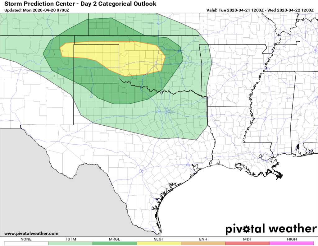
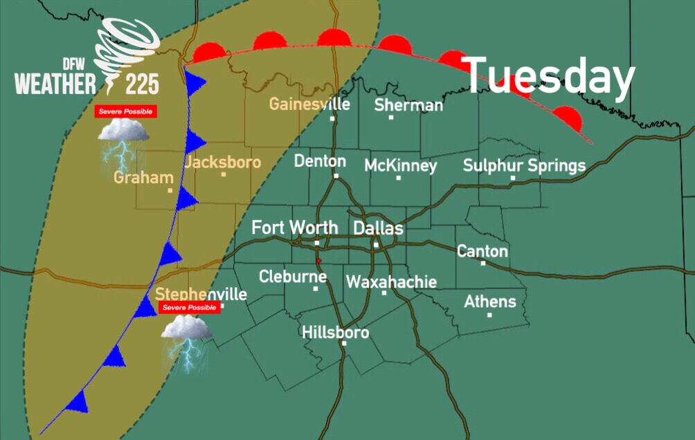
To start the forecast, for Day 2 (Tuesday) the SPC has placed parts of Northwestern TX, under a (1/5 green) Marginal risk for some strong storm activity. This mostly covers areas to the northwest of our coverage area, however, there is a small chance we could see some stronger storms for our western and northwestern counties, west of the I-35 corridor during the day. The main threats with these storms would be some hail anywhere from pea to quarter sized, and gusty 45-60mph winds. If any storms were to approach or reach our western and northwestern counties, they would be likely late afternoon into the overnight. NOT every storm on Tuesday will be strong or severe, as widespread severe weather looks to be unlikely. Strong activity would remain isolated. This is our thinking for now, we’ll let you know if anything changes.
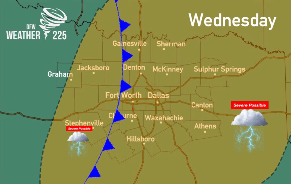
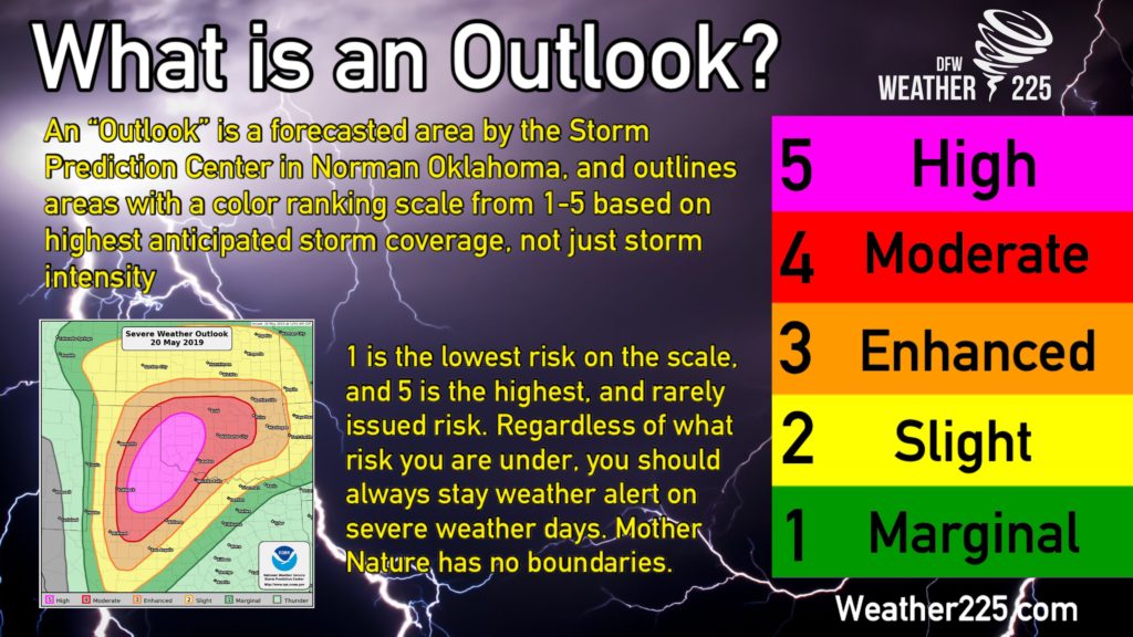
For Wednesday, the SPC has issued an outlook for Day 3, with a large portion of NTX under a (2/5 yellow) Slight risk, and the remaining parts of the areas we cover under a (1/5 green) Marginal risk for storms. Remember, these outlooks and categorical colors don’t just mean storm intensity, they are placed for where confidence is best for better storm coverage.
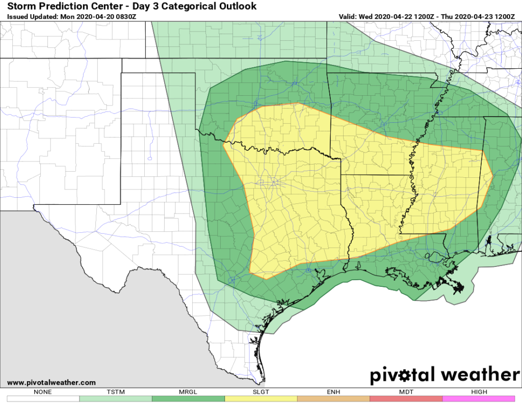
A positive tilt system will move into the southern Plains region and move towards the East on Wednesday with broad 50-60 knot mid level winds, combining with a weaker area of low pressure moving across Oklahoma into Arkansas. A dry line will set up in western TX during the day and push East through a large portion of the state. Ahead of that dry line, dew points in the 60s, and surface heating with temperatures into the 80s, will cause unstable air across the I-35 corridor, where conditions look to be best for instability, and development. Among the development, some could be supercells, with mainly a Large Hail threat.
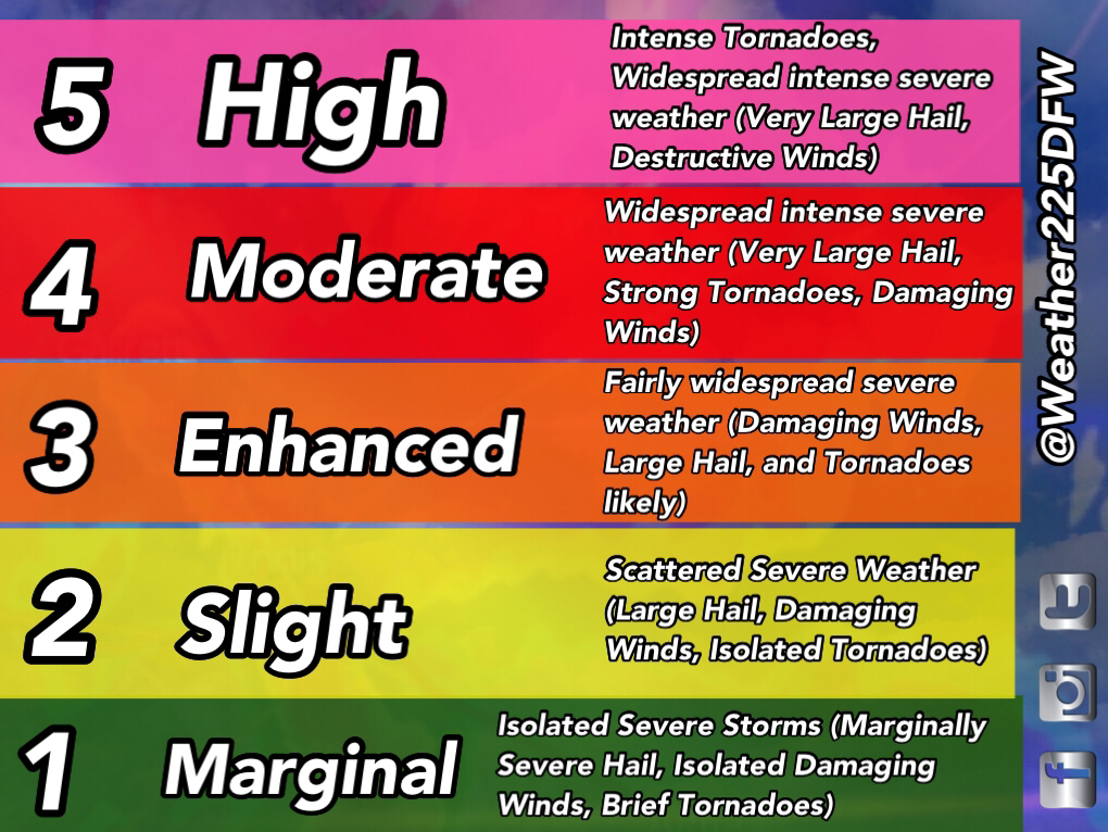
For Wednesday, the outlook also has a black outlined area for a “significant” threat, simply meaning a threat for some very large hail, could be possible during the day. We know “significant” can be a scary word, this is simply meaning big hail could be a threat, this is the terminology for the outline in an outlook. However, this is what the outlook is saying for now, and may change in the coming days so stay tuned.
All types of severe weather may be possible with this system, however, for now we don’t know fully to what extent. We wouldn’t worry for now just to ease any fears. We’re watching this carefully. This is what we are thinking at this point, we know with any system there’s a fair share of hype online days out. We want to give you the information for what’s forecasted for now, in an un-hyped manner to ease fears for those with storm anxiety.
There’s still some uncertainties for this system, and we may not fully know until we get to Wednesday, such as if we get rain and storms into Wednesday morning and if that activity would stabilize the atmosphere. Or If there will be cloud cover to limit surface heating.
What can you do? Should you panic? Is this uncommon?
No this is not a reason to worry or panic, and no it’s not uncommon. For the southern Plains, we see severe weather set ups every year, with April and May being the most active periods for severe weather in the spring.
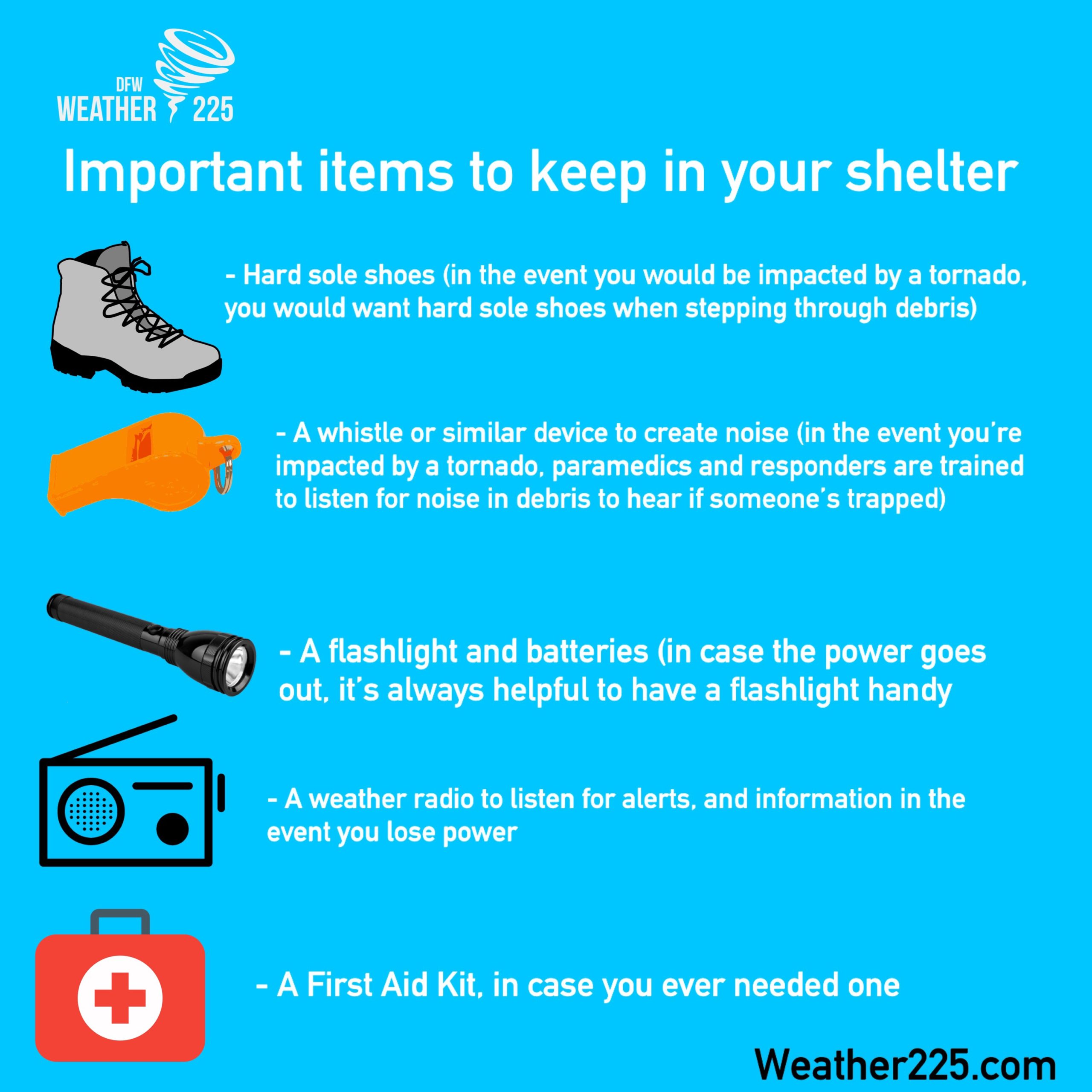
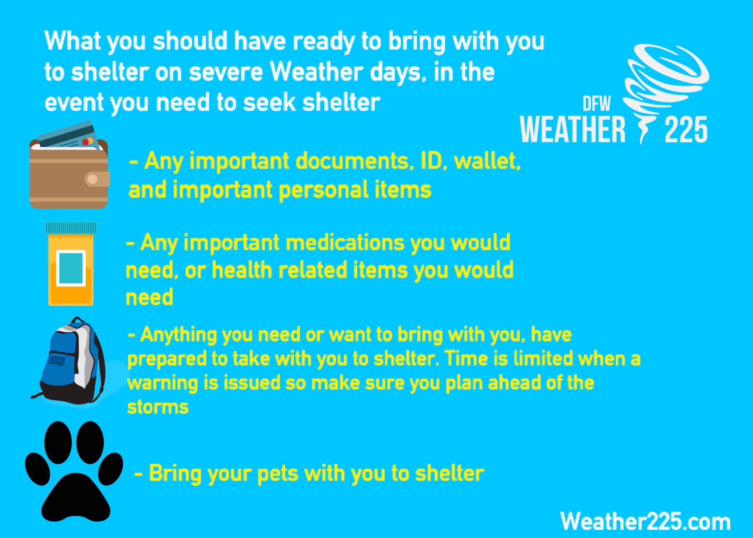
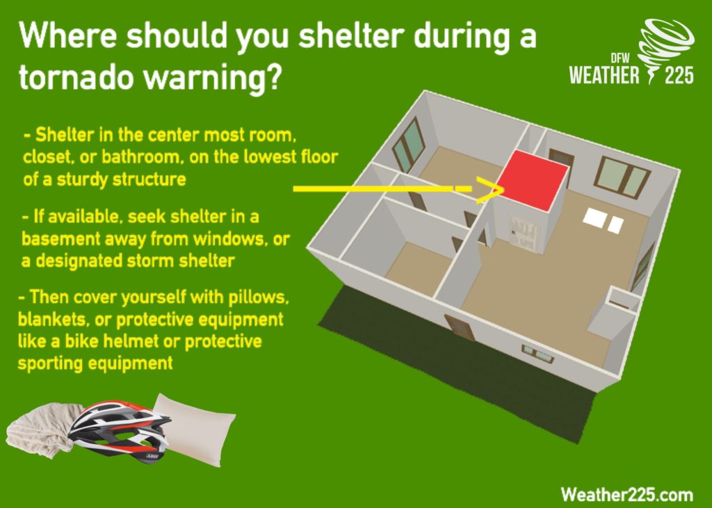
The best thing to do, is to review your severe weather safety plan. (Know where to shelter, plan where you could cover your car during a hail storm, make sure you have ways to receive warnings and alerts during severe weather, check NOAA Radio batteries, make sure you would have everything you need in the event you need to seek shelter).
Bellow are some graphs we’ve made for storm season in general. These are helpful tips about what you should take with you in the event you ever needed to seek shelter from a tornado. And what to have ready in the event you needed to seek shelter. These graphs are NOT because we’re anticipating any type of threat, these are just safety tips in general.
Stay up to date with the latest with Weather225! We’ll get you the latest as we get closer to Wednesday. But to ease any fears, there’s still uncertainties with this threat, and this is nothing to worry about at the moment. We’re just giving everyone a heads up because there could be a threat in the new future. Until then, enjoy the start of your week!
– JW
Leave a Reply