
Good morning North Texas, today we have a chance for some shower and storm activity. Some of these could be severe. We’ll get into the risks and timing for activity based on the latest trends. But let’s be clear to ease any fears, not everyone will see severe weather today, however, we should all stay weather alert throughout the day because there is a threat.
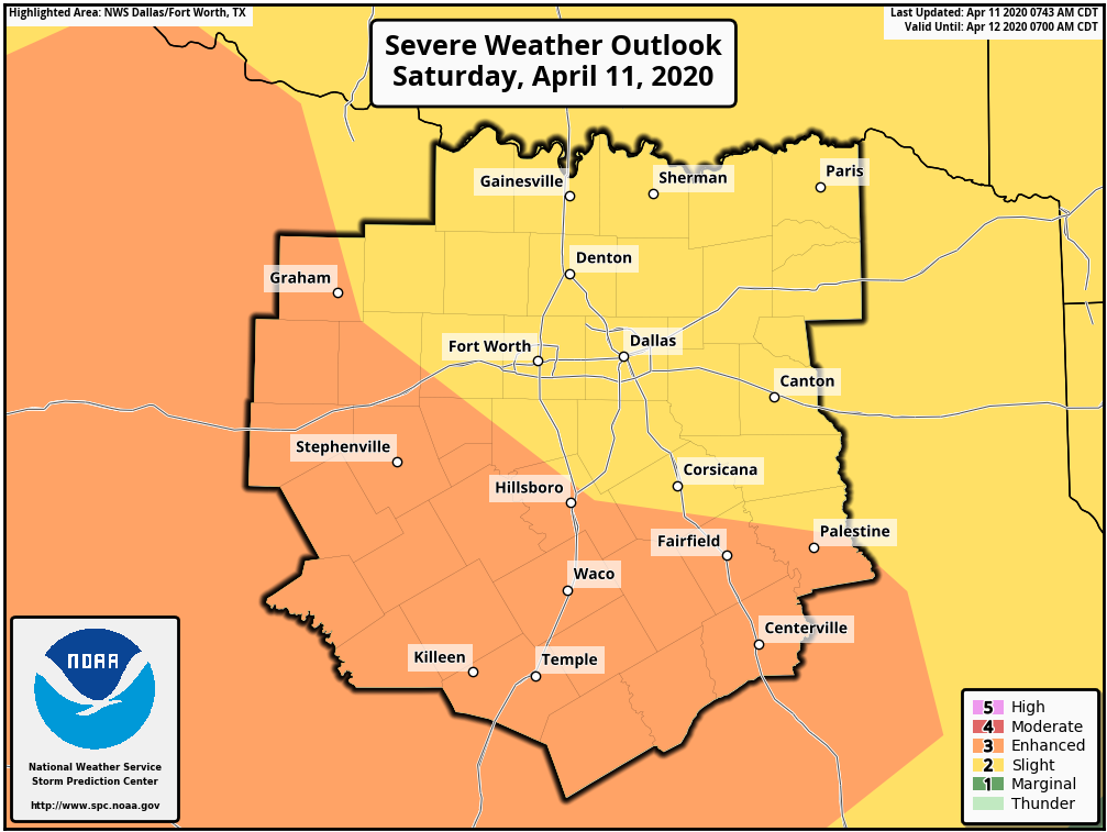
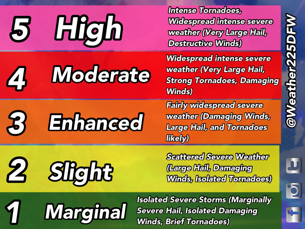
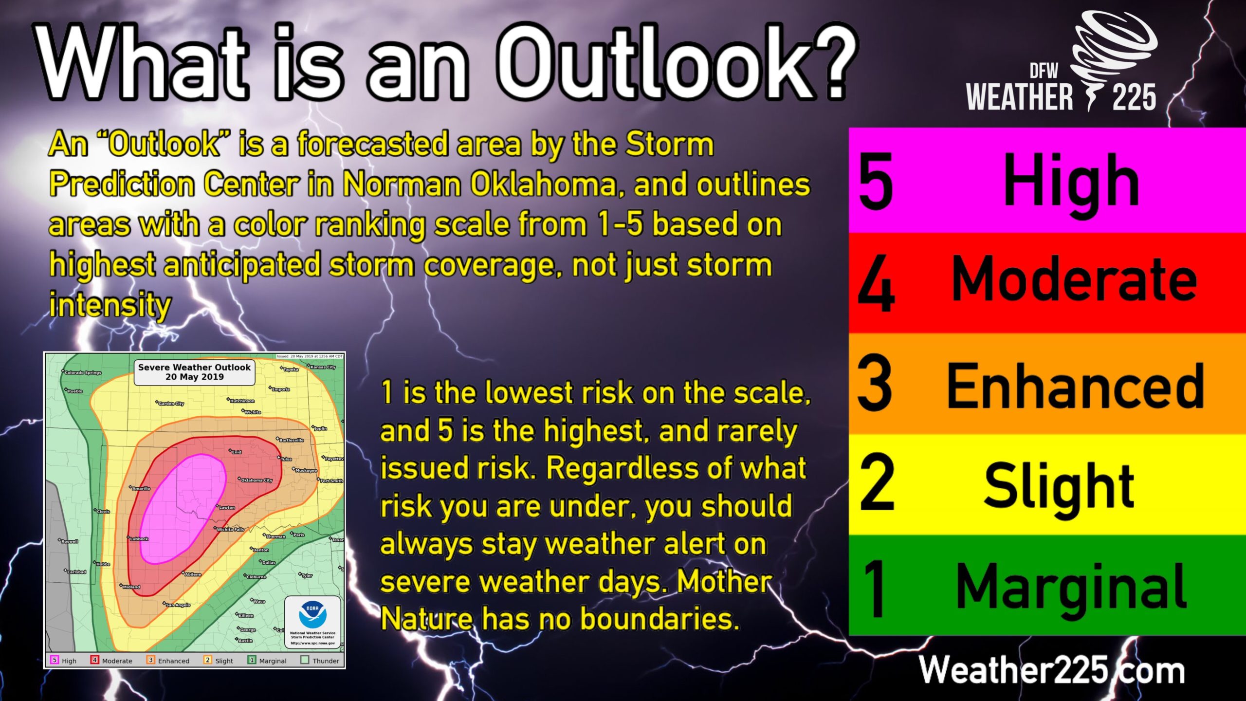
For our viewing area, we have either a (2/5 Yellow) Slight Risk, or a (3/5 orange) Enhanced risk in place for potential storm activity later this afternoon into the evening. As mentioned in our other forecasts, these SPC categorical outlooks simply mean anticipated storm coverage, not just intensity. Higher risks simply mean higher confidence in coverage, however Mother Nature has no boundaries, so regardless what risk you’re under, you should always stay weather alert on any day with a severe weather threat.
All types of severe weather will be possible today, as there is currently a threat for some more discreet cell development out for our western counties, west of I-35. Timing for the whole area we cover looks to be between 2pm-12am.
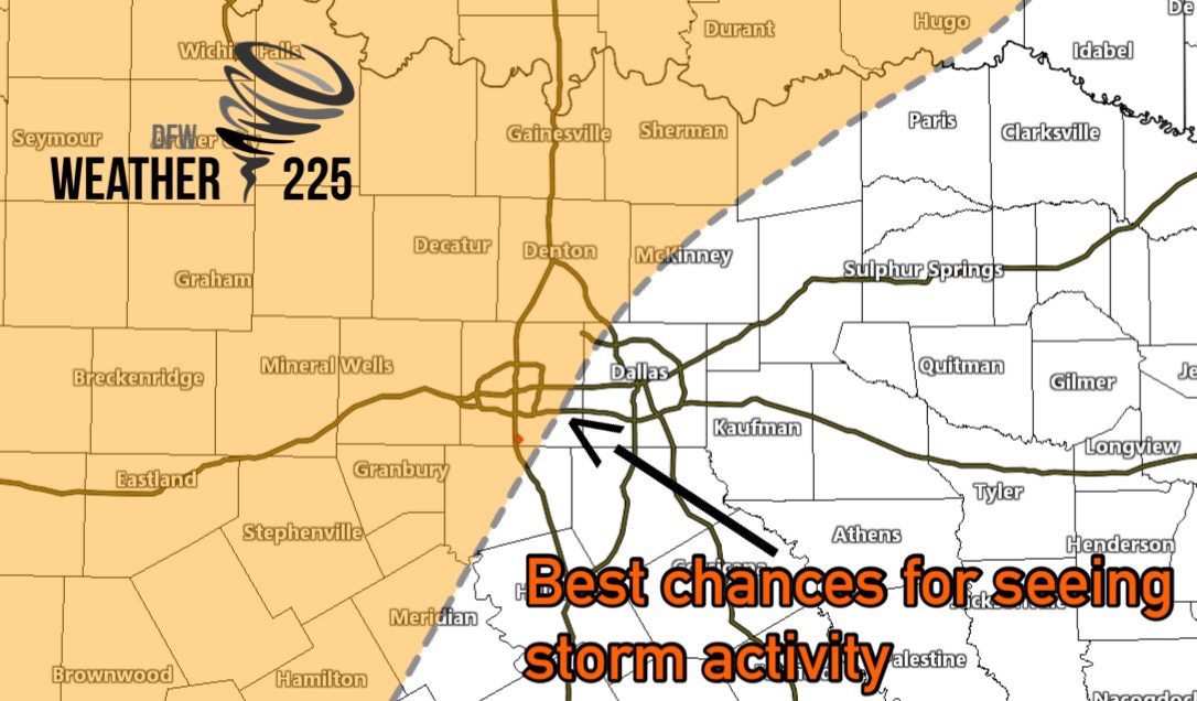
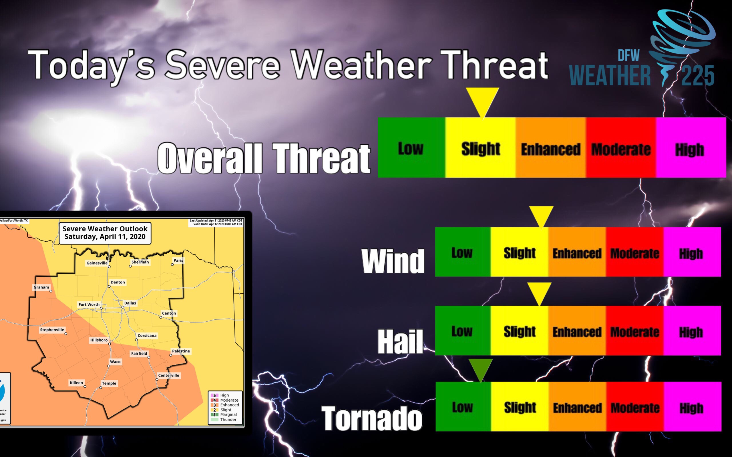
For now we have our threat index at Slight, because of our DFW viewers, and since the slight risk covers more of our viewing areas than the enhanced risk. However, our western counties should stay alert today for the threat of severe weather.
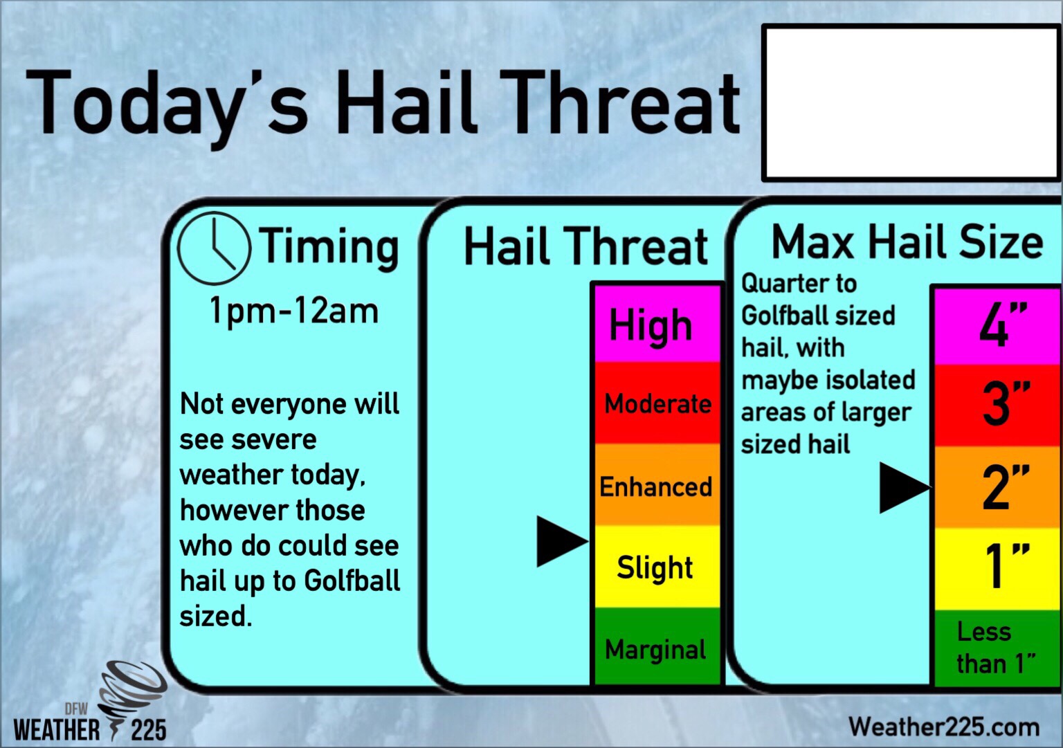
For our exclusive hail index, we’re forecasting hail up to golf ball sized possible with the strongest storms, this activity looks to be mainly west of I-35, however a hail threat cannot be ruled out for areas closer to the metro as well.
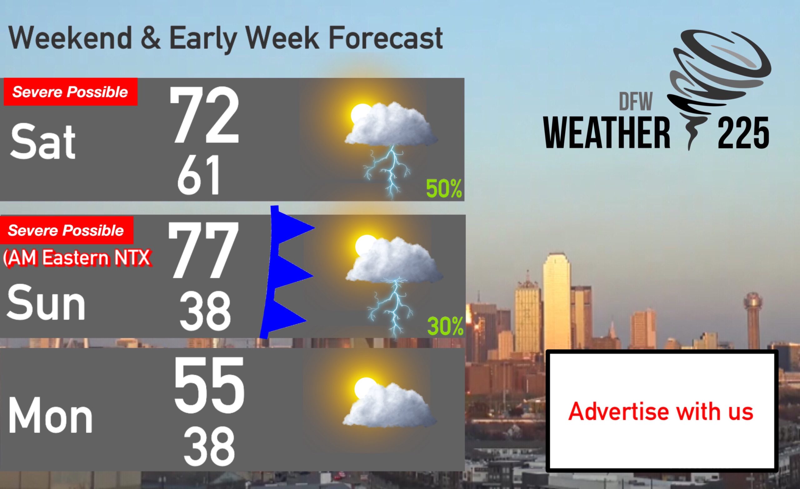
We’ll also have to watch for a threat tomorrow morning, for areas mainly east of I-35, as the front pushes through the area, and into East TX. At this time it appears damaging winds would be the main threat.
We’re giving you the information of what to expect. But we would like to ease any fears for those with storm anxiety. This threat is nothing major or historic, and not everyone will see this activity. There is a threat, and we should be mindful of it, and have a way to receive warnings IF warnings are issued just to be safe. If you stay aware of the weather today you’ll be just fine. I grew up with storm anxiety so I understand the fears of storms. In my experience, I found my fears become less debilitating learning about severe weather, and that’s why we like to teach and inform here on Weather225, so you can get a look at what to expect, in a way that reduces fears.
So quick recap:
Our Timing- 2pm-12am
Threats- All types of severe weather are possible, with the greatest threats being west of I-35 in our opinion. However, DFW residents should remain weather alert today as well. Large Hail up to Golf Ball sized, 60-65mph winds, and an isolated tornado or two cannot be ruled out.
What should you do? Be aware of the weather, and have a way to receive warnings if they’re issued.
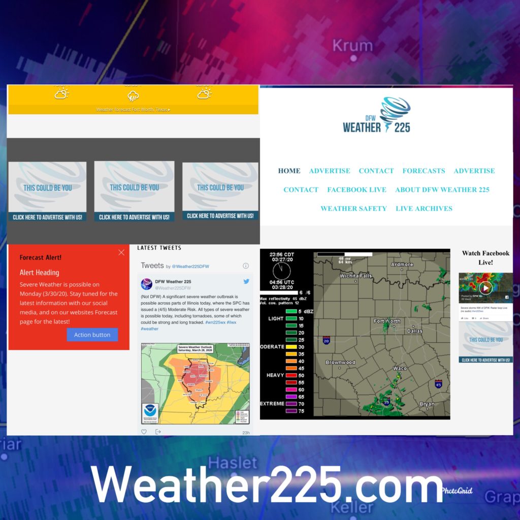
And of course stay tuned to Weather225 for the latest. You can track the activity with the radar on our home site, as well as track the latest warnings and information from our twitter feed located on the side bar’s of our website.
Leave a Reply