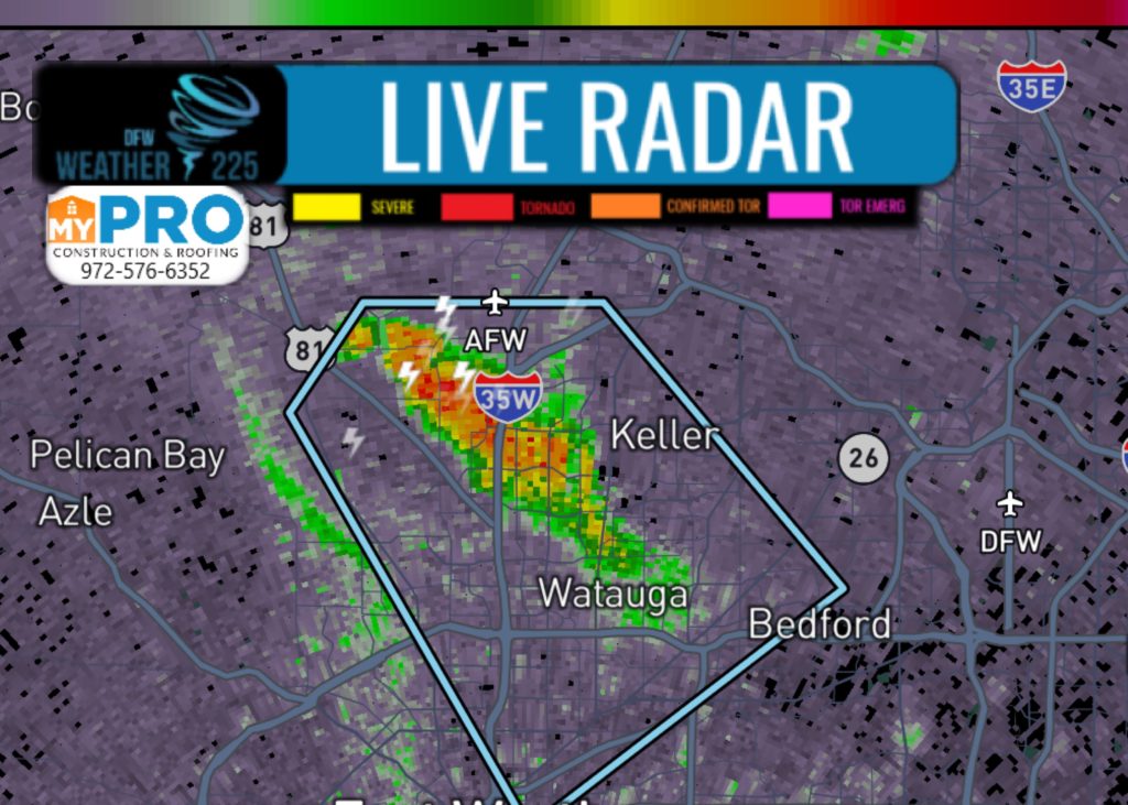
At 640 PM CDT, Doppler radar was tracking a strong thunderstorm over Haslet, or near Keller, moving southeast at 10 mph.
Penny size hail and winds in excess of 40 mph will be possible with this storm.
Locations impacted include... Fort Worth, Bedford, Haltom City, Keller, Hurst, Watauga, Colleyville, Saginaw, Richland Hills, Eagle Mountain, North Richland Hills, Pecan Acres, Blue Mound and Haslet.
PRECAUTIONARY/PREPAREDNESS ACTIONS...
Frequent cloud to ground lightning is occurring with this storm. Seek a safe shelter inside a building or vehicle.

Leave a Reply