
Good Saturday evening NTX this is a quick update on the strong front & rain chances we’ve been mentioning for a couple of days now for this upcoming Monday and Tuesday. The latest NAM & NAM NEST model runs have come in this evening showing a glimpse of what we could expect Late Monday into Tuesday.
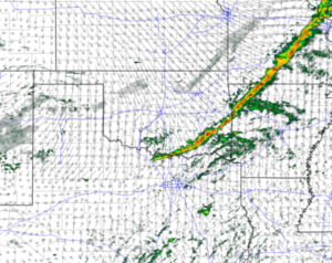
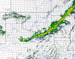
Yes the models are showing a line of showers and isolated thunderstorms but don’t get to excited just yet. To start, the images on here were both shots taken from the latest NAM NEST model and shows timing for rain activity between 11pm Monday and 9am Tuesday. As of now this doesn’t appear to have any sort of severe weather concerns, if I were to guess the only sort of storm threat would really only be isolated gusty winds and lightning in some spots if there’s any threats at all. The rain coverage will be somewhat spread out across the region however total amounts wont be all to impressive, as only 0.5″- 0.8″ of rain is expected. Its not much but we’ll take what we can get! The higher the rain chances get the further east and NE of DFW you go.
Besides the rain chances, another part to note from this forecast is the change in temperature behind the front. Models are projecting that area highs on Monday will be from 73-76 before lowering into the mid to lower 50’s. In the days following area highs will stay around or bellow 60 for the remainder of the week.
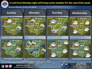
Gusty winds are to be expected behind the front as it pushes through, we could see a wind advisory issued late Monday for the region. Winds behind the front could exceed 15-25mph, so you’ll want to keep that in mind if you have any loose outdoor furniture or decorations. Have a good rest of the weekend and check back for the latest
Leave a Reply