
We officially have our first outlook for tropical development in the Gulf of Mexico for the 2022 season, however, this outlook is a very low 10% chance for development within the next 2-5 days. A low pressure system off gulf coastal areas from Alabama and Florida panhandle, is producing disorganized storm development. As this system moves inland over the next 48-72 hours, the system will weaken and not reach cyclone status or strength. However, this system could bring heavy rain and a flash flooding concern for parts of the gulf coast, and southeastern US over the next 1-2 days. Bellow is the official outlook from the National Hurricane Center.
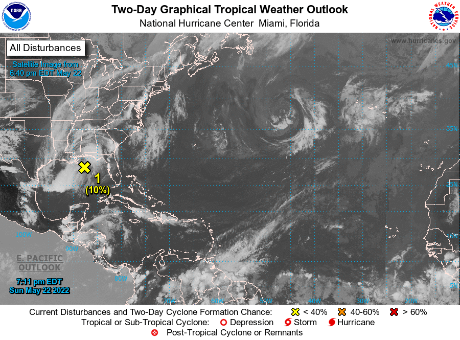
Tropical Weather Outlook
NWS National Hurricane Center Miami FL
800 PM EDT Sun May 22 2022

For the North Atlantic...Caribbean Sea and the Gulf of Mexico:

1. North Central Gulf of Mexico:
An area of low pressure is located over the north-central Gulf of
Mexico about 150 miles south of Pensacola, Florida.  This system is
producing disorganized thunderstorms and gusty winds across portions
of the Florida Panhandle, southern Alabama, and over the central and
northern Gulf of Mexico. Surface pressures remain high, and strong
upper-level winds should prevent significant development before this
system moves inland over the central Gulf Coast later tonight or on
Monday. Regardless of development, heavy rainfall and gusty winds
are expected to continue across portions of the central Gulf Coast
and will spread across the southeast U.S. during the next day or so.
Additional information on the rainfall and flooding potential can be
found in products issued by your local National Weather Service
Forecast Office and Excessive Rainfall Outlooks issued by the
Weather Prediction Center.
* Formation chance through 48 hours...low...10 percent.
* Formation chance through 5 days...low...10 percent.

Forecaster Cangialosi
Leave a Reply