
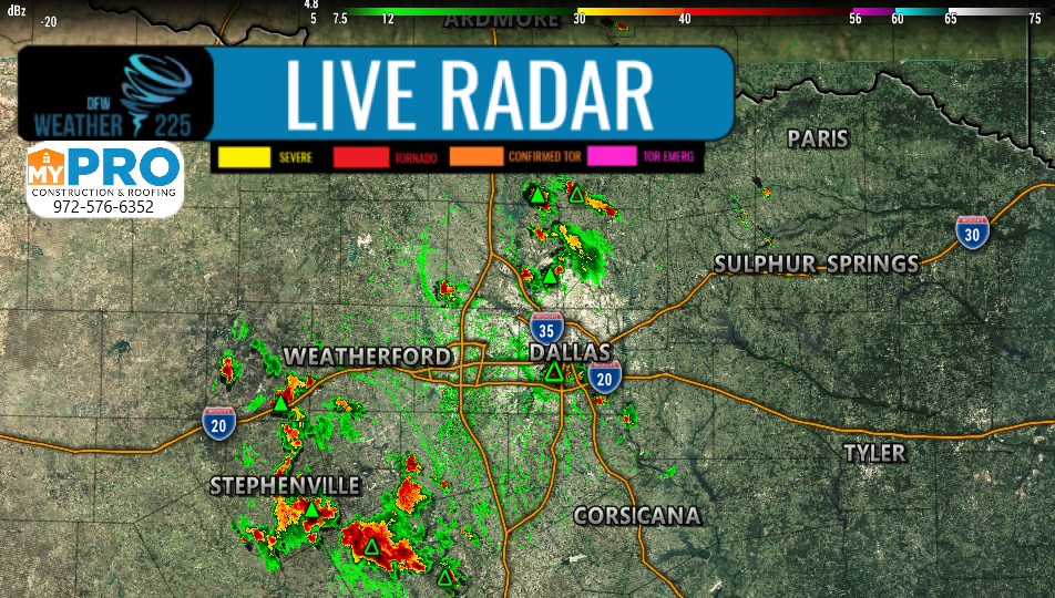
Good afternoon North Texas. Currently we have scattered isolated showers/storms ongoing across parts of the region. Currently these are capable of localized heavy rainfall, and lightning. Small hail smaller than Nickel sized, and 40mph winds are possible with some of these storms.
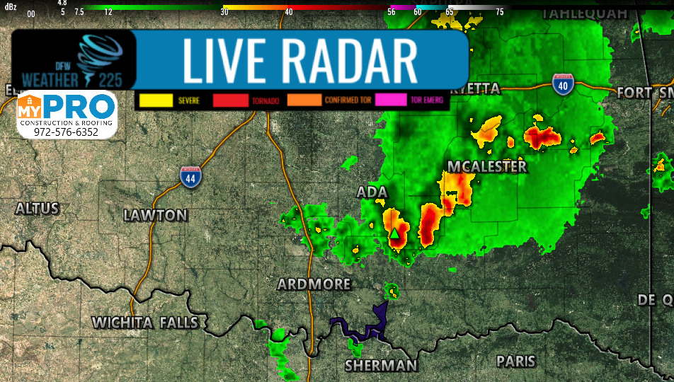
We’re also monitoring a cluster of storms in south central Oklahoma, moving South/Southeast towards the Red River. New development with this cluster of storms is possible with an outflow boundary that has developed ahead of those storms. We’ll monitor these as they approach NTX over the next 2-3 hours. Some of these could be strong, however, not all storms will be strong.
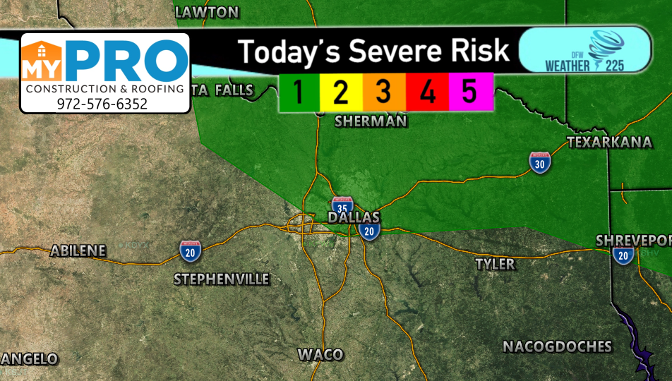
The SPC has placed parts of NTX, including parts of the Metroplex, with a (1/5 Green) Marginal risk for possible strong storm activity this afternoon into early evening. This threat is nothing major, but we’ll be keeping an eye on the sky. Again NOT everyone will see strong, or even general storm activity this afternoon and evening.
Track the activity with our interactive maps!
-JW
Leave a Reply