Fayetteville, ARK– As we head into the final days of September and head into October, we have some headlines to talk about for the forecast over the next 7-10 days.
After an extended period of time of hot, dry, and miserable weather, we are about to head into a more turbulent and welcomed weather pattern over the next several days. We finally have some area-wide rain chances and even some cooler weather to highlight!
Rain chances next week:
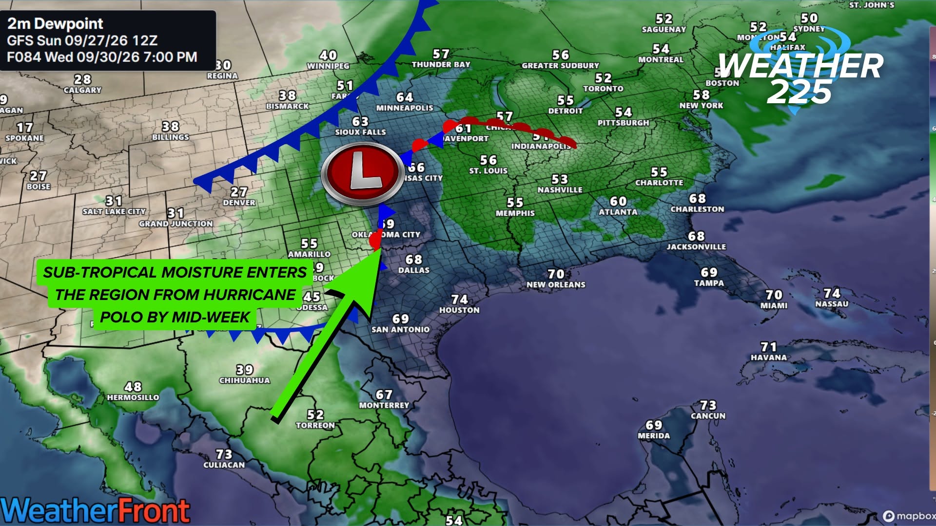
The pattern by mid-week this upcoming week will become turbulent, with daily rain chances and a chance for measurable, potentially drought-impacting rain for parts of the region. This will be thanks to an upper-level system that arrives, combining with a round of post-tropical moisture remaining from Hurricane Polo.

This will be the perfect combination for much-needed rainfall. As of this update, many areas will likely see rainfall between Wednesday and Friday, with some areas potentially seeing between 2-5″ of rainfall. Not everyone will see these higher totals, as more likely area-wide totals will likely be between 0.50″-2″, but localized pockets of higher totals remain possible.
Cooler Temperatures???
As we head into October, our climate data shows average highs ranging area-wide from the mid to upper 70s, with average morning lows in the mid to upper 50s. That’s our normal temperatures, but as we saw in September, Mother Nature has not stayed on the normal track with our temperatures. So when will it cool off?
Well… It may be sooner than you think.

Latest model guidance and a starting trend from the last several runs indicate fall-like temperatures between 10/03 and 10/14, with afternoon highs potentially in the 60s and 70s. And morning lows in the 40s, with some guidance at times also hinting at some upper 30s.
Now, does this mean this will 100% without a doubt happen? No. Long-range guidance is uncertain and flip-flops the further out you get, time-wise, with any given forecast.
So why even share this, is it not accurate?
This uncertainty doesn’t mean it’s useless to even look at. As I previously mentioned, “trending” is an important context for extended forecasts. When forecasting long-range, we look for trends: is the same output or similar output occurring over and over with every new run? That’s the trend we look for. If a model shows over 10 runs with 10 completely different forecasts with no similarities, then there isn’t a trend or confidence in any particular forecast. However, if those 10 runs have multiple or most runs that share the same or closely similar output, then there’s a trend to monitor, and some level of confidence in the potential for a certain forecast in the extended view.
Does the extended forecast with these potential low temperatures make sense???
Does the forecast showing lows potentially in the upper 30s to lower 40s make sense? While it may feel early because of our current extended warm and miserable pattern, it’s climatologically normal. Below is the average starts and records for yearly frost/freezes.


As of this update it’s not gauranteed we see lows this cool. And for transparency the runs with lows in the upper 30s doesn’t mean freeze / frost occurance.
On average, our first light freeze/frost occurs in October for parts of the area, particularly parts of Northwest Arkansas and Southwest Missouri. Record early freezes occur in October in many locations.
So, to summarize this, it does NOT mean freeze/frost is in the forecast or temperatures will get that low. The reason we even mentioned it is because there is a trend for cooler temperatures in the models, but also some free weather apps you may use with no human input may show some pretty outrageous numbers forecast-wise in their 7-10+ day forecasts.
So while those exact temperatures aren’t guaranteed, take this as a sign that our multi-day or multi-week occurrences of temperatures of 98º-104º are over. However, that doesn’t mean we won’t see temperatures in the 90s after September; some peak heating records across the region, depending on where and the day, are in the 90s.

Be sure to download our FREE Weather 225 Streaming APP on Roku by clicking the image above!
You can also watch our main stream and other streaming content on our YouTube (click the image below)
About the Author